Explore Caldeira, Capelinhos Volcano and Other Volcanoes
©Rita Rosa | Azores Experience


The origins of Faial, which is entirely volcanic, date back 800,000 years to the Volcanic Complex of Ribeirinha, on the eastern side of the island. Today, the island is structured around a large central volcano, the Caldeira, formed more than 10,000 years ago. Over the centuries, there has been constant volcanic activity, most recently in 1672-1673 during the eruption of Cabeço do Fogo, and in 1957-1958, during the eruption of Ponta dos Capelinhos.
Some volcanic formations can be visited by car while others can only be accessed on foot, along trails. It is also possible to follow the famous 10 Volcanoes Trail that starts at Caldeira, the highest part of the island, and visits 10 different volcanoes before reaching the magnificent landscape of the Capelinhos Volcano, formed only 60 years ago (find out more at “Trail Hikes”).
Discover some of the volcanic formations that can be visited on Faial:
©The Plantation Faial
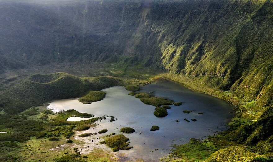
Caldeira
Access: by car or on foot
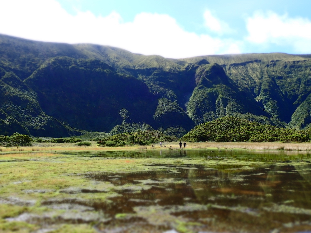
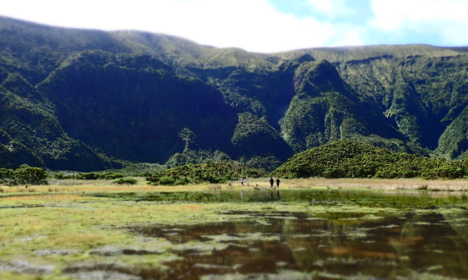
Caldeira is circular in shape, has a diameter of about 2,000 meters, an average depth of 400 meters, and is covered by exuberant Laurissilva vegetation. Located in the center of Faial, Caldeira is the island’s main landmark and its interior represents one of the most pristine patches of native forest in the Azores. It is one of the remaining places to visit where you can still feel and imagine how the Azores used to be before people arrived. Caldeira do Faial is a nature reserve of great importance in the Azores, and the views from its scenic lookout are a must-see.
The crater is the result of the successive subsidence of a 410,000-year-old volcano, whose last eruption took place only 1,000 years ago and covered about 75% of the island’s surface with incandescent pumice stone. At the bottom of the crater there is a cone resulting from its last eruptive phase, whose shape, curiously, is reminiscent of the island itself.
You can visit the crater in 3 different ways:
- By visiting the Caldeira Lookout – Caldeira can easily be accessed by car. It is just a 20-30 minute drive from Horta through the island’s beautiful highland landscapes. There is a parking lot at the top and you can reach the lookout via a pedestrian access tunnel. The view inside the gigantic crater is impressive. If you want to enjoy a little more of the views and the unique surroundings, we suggest you take a short 15-minute trail that takes you to Monte Gordo, the island’s highest point.
- By hiking along its perimeter – This is one of Faial’s most iconic trails. The circular 8km-long path takes you all the way around the volcano along the edge of its crater. The terrain is uneven and has small obstacles but it is accessible to people of various ages with different levels of fitness and experience. The views are extraordinary, complementing the perspective of the crater’s interior with panoramic vistas of the island’s coastline and neighboring islands. The trail can be walked or run, with or without specialized guides and companies (find out more at “trail hikes”)
- By descending the crater – The descent into the interior of the crater is a memorable experience! In its interior is one of the best preserved patches of Laurissilva forest in the region and of great importance for the natural conservation of endemic habitats in the Azores. The crater can only be descended with a certified guide and only a certain number of people are allowed every day. The trail, classified as difficult, is narrow and steep and descends the slope in zigzags. In some areas you may have to use your hands. It is a humid habitat and it is common to find mud and a flooded area at the bottom.
Important: Given the mountain-like conditions, the weather is not very stable and visibility may not always be good. We recommend that you prioritize the visit to Caldeira and take the opportunity when it arises. This way you will ensure that you do not leave the island without seeing one of the Azores’ greatest natural features.
©Shoot4ward

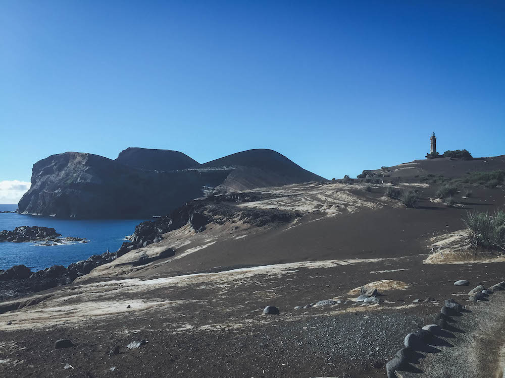
Capelinhos Volcano
Access: By car or on foot
Visiting Capelinhos Volcano is a remarkable experience. The landscape was formed by the 1957/1958 eruption and is somewhat suggestive of what we imagine the landscape on the moon or Mars might be like. In contrast to the traditional Azorean image of green fields, the view of the volcano and all of its surroundings is marked by aridity and the blackness of the volcanic ash.
Part of the Capelo volcanic complex, Ponta dos Capelinhos was the last volcano to erupt, and its consequences are still very visible today. One of these was the addition of about 2.5 km2 of extra landmass with the solidification of the lava that remained above sea level.
This is a place that summons us to the moment of its creation. At every instant, we imagine the titanic forces involved in the eruption and that are still so present; we feel the echo of the volcano rising in the middle of the sea 60 years ago, growing and connecting itself to the island, and adding a new piece of land to Faial.
During the visit you can:
- View the volcano and the landscape surrounding the lighthouse, which survived the eruption;
- Visit the region of the old whaling village that was buried during the eruption by following the Interpretive Circuit––Whalers’ Paths
- Walk a small part of the 10 Volcanoes Trail that crosses the arid landscape of the Capelinhos Volcano
- Visit the Capelinhos Volcano Interpretation Center
- Climb the lighthouse and enjoy the panoramic views
Capelinhos Volcano Interpretation Center
This is the most popular environmental visitor center in the Azores. It is informative, educational, and scientific with a set of exhibitions that focus in particular on volcanology, addressing the eruption of the Capelinhos Volcano, the formation of the Azores archipelago, and the various types of volcanic activity around the world. There is also an exhibition on the richness and architectural diversity of Azorean lighthouses, and a large collection of rocks and minerals.
It was nominated by the European Museum Forum for “Best Museum in Europe” in 2012.
The building is buried so as not to interfere with the pre-existing landscape, allowing you to enjoy this recent volcanic landscape (the eruption occurred in 1957/58). Besides a set of exhibitions, the Center has an auditorium and a café. At the end of the visit, take the opportunity to climb the spiral staircase to the top of the lighthouse. From the top you can enjoy a unique view of the entire area surrounding the volcano.
©Rê Schermann

Cabeço dos Trinta
Access: By car up to Levada at Capelo and about 1km on foot afterwards
The visit to Cabeço dos Trinta is notable mostly because the entrance is through a tunnel, which leads to the center of the crater and gives the sensation of being inside a volcano! Cabeço dos Trinta is located near the beginning/end of the Levadas Trail in Capelo, at an altitude of 752m.
of 752m.
©Siaram

Cabeço Verde
Access: By car or on foot
The main attraction of Cabeço Verde is the view and the fact that it is accessible by car. On days of high visibility you can see the island’s northern coastline, Capelinhos Volcano, Cabeço do Canto and the Atlantic Ocean in the background.
©Rê Schermann

Cabeço do Canto
Access: On foot
Cabeço do Canto is accessed at an altitude of 346 meters via a beautiful trail from Capelinhos Volcano or from Cabeço Verde. In addition to the beautiful landscape, on the way you will find Furna Ruim, a volcanic cave about 55 meters deep that is part of the Natura 2000 network of protected areas.
©Siaram

Cabeço Gordo
Access: By car or on foot
At 1,043 meters above sea level, Cabeço Gordo is the highest point on the island. It is located on one of the slopes of the basaltic volcano of the island of Faial and is the main geomorphological unit of the volcano. From the summit, on clear days, the view of Faial and the neighboring islands of Pico, São Jorge, and Graciosa is magnificent. It gives you a real sense of the archipelago!
©Rê Schermann
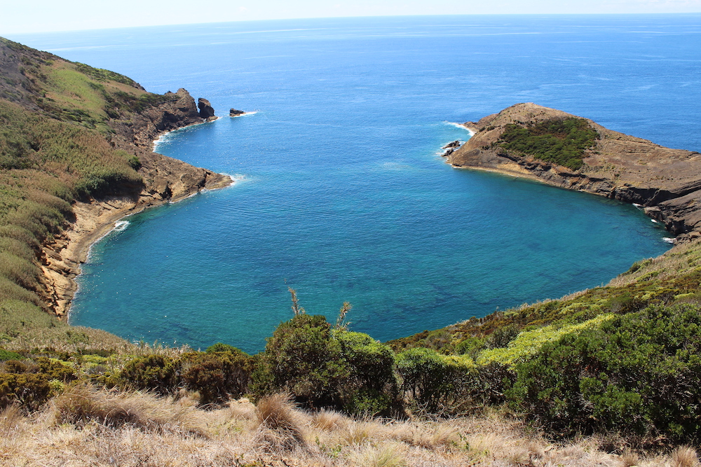
Calderinhas
Access: By car or on foot
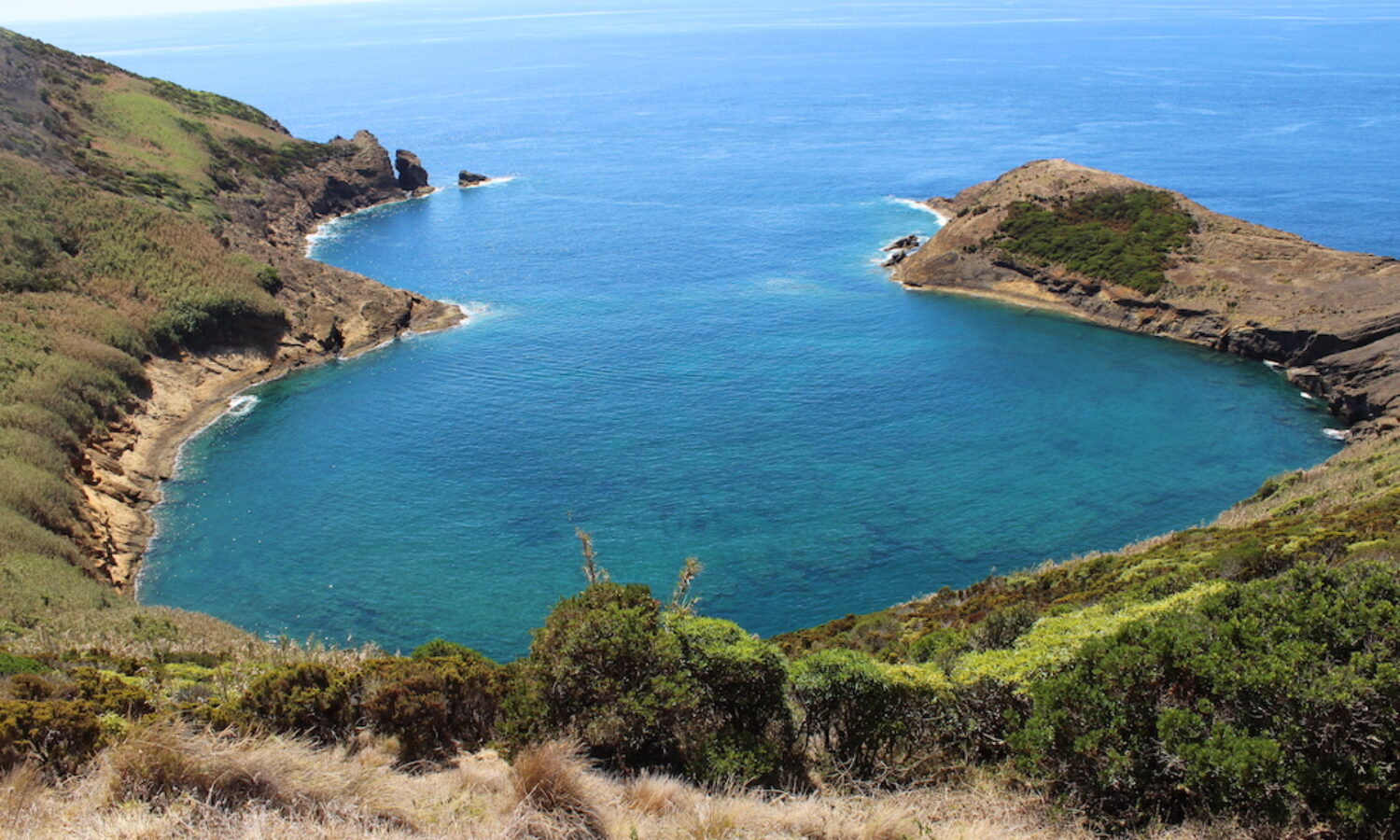
Located in Monte da Guia, Caldeirinhas, also known as Caldeira do Inferno, is formed by two twin volcanic craters, partially submerged by the sea. They are part of the Caldeirinhas Natural Reserve and cover a total area of 10 hectares.
These craters flooded by the ocean are a nursery for marine life, such as salemas (Sarpa salpa) and ballan wrasse (Labrus bergylta). They are of great biological interest due to the endemic species of local flora, such as heather (Erica azorica) and native beech (Morella faya).